
Topcon MAGNET Collage
| Make | Topcon |
| Model | MAGNET Collage |
| Type | Topcon Mass Data & Mapping |
How can we help?
Description
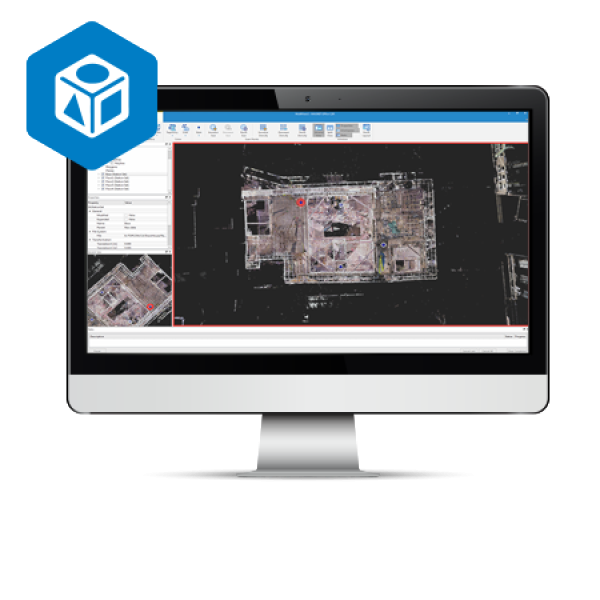
Intuitive and flexible point cloud processing
Process, combine and analyze multi-source point cloud data from traditional survey instruments as well as reality-capture laser scanners, mobile mapping systems and UAVs. Easily export to industry-standard modeling or CAD software or directly publish online with MAGNET Collage Web for improved collaboration among stakeholders. Leverage survey control points or known geographical coordinates to further accelerate dataset processing.
Models
Applications
- Design & Take-Off
- Mapping
- Forensics
Features
- Segment and reduce point clouds to export to third-party software
- Extensive projections and geoid exports
- Combine mobile and static scan data into one immersive 3D environment
- Advanced matching and ground-control functionality for a variety of sensors
- Combine civil, mapping, BIM and survey data
- Faster point-cloud processing and reality capture data handling
Links
- MAGNET Collage and Collage Web - Brochure
- Topcon Workplace Catalog
- Vertical Construction: Scanning Solutions - Brochure
- MAGNET digital booklet
Copy Set
Applications
- Design & Take-Off
- Mapping
- Forensics